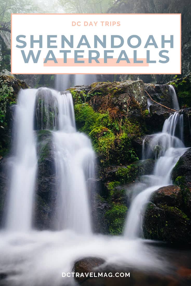
Shenandoah National Park waterfalls offer visitors so many excuses to visit the park, as well as options of what to do while exploring the Shenandoah Valley.
Below you will find all the pertinent information for the nine main waterfalls within the park. We are letting you know the best starting locations, distances, and the difficulty of each hike. There are also a few tips on the least-strenuous routes to take.
Best time to see Shenandoah National Park Waterfalls
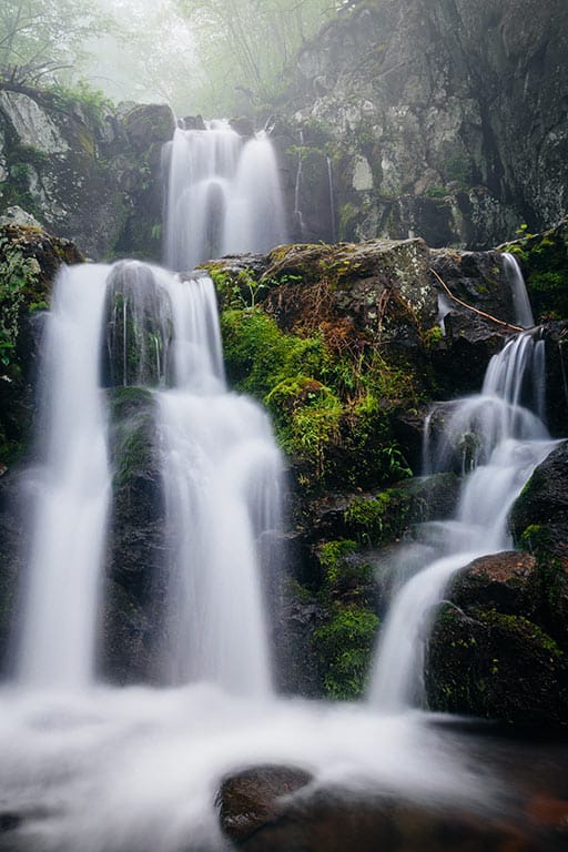
A spring hike is a prime time to visit the waterfalls since some falls tend to dry up to a trickle by late summer. However, a journey to the falls after a rain during the fall foliage peek is also breathtaking. Enjoy a waterfall hike or two because there are no ugly waterfalls in the park. For those exploring national parks in Washington DC, Shenandoah’s falls offer a spectacular experience just a few hours away.
We have listed the Shenandoah waterfall trailheads in order from north to south.
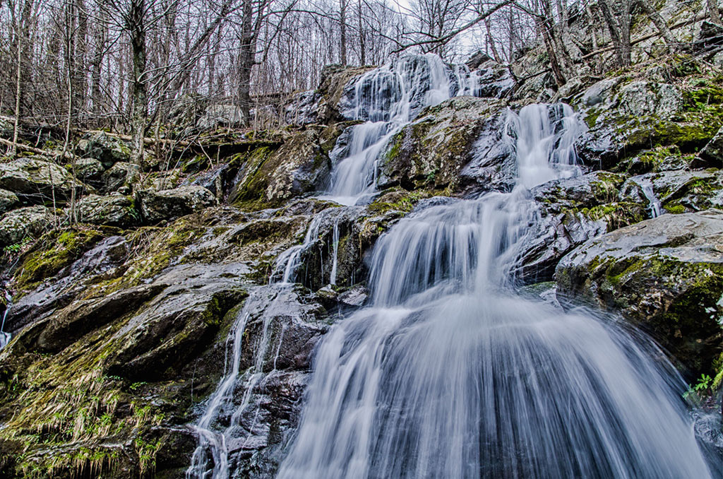
Overall Run Falls
- Location: Mile marker 21.1 or 22.2 Mathews Arm Campground
- Length of hike: 5.1-6.5 miles round trip
- NPS Trail Information
- Pet Friendly: Yes, your dog may join you on this trail.
To get a view of the tallest waterfall in the Shenandoah National Park, put on your hiking boots. Head out on the moderately strenuous route that leads you down the mountain 1,348 feet before getting a chance to view this 93-foot tall beauty.
Just past the Hogback Overlook, you will find the trail’s parking area and the Appalachian Trail. Take the path south for a half-mile to the blue-blazed Tuscarora-Overall Run Trail. For those who come in from the campground, take the Tuscarora-Overall Run Access Trail to this point.
Just after this intersection of trails, look for the viewpoint on the left-hand side. The lovely viewpoint is a terrific turnaround point for those unable to walk the whole way.
For those heading further, continue down the steep trail for another 1½-mile. If time allows, take at least some of the side trails along this route to the falls. The trails lead to gorgeous views of the gorge.
Once you get to the scenic hollow, explore the area and enjoy a seat on the rock ledges near the falls before the tough return climb. Take time to listen to the soothing sound of the falls as it cascades down 93 feet of rocks.
To see this waterfall at its best, visit in the spring, fall, or after a heavy rainstorm. The falls may be dry in the summer.
For more, check out the best hikes to waterfalls in Virginia

Whiteoak Canyon Falls
- Location: Mike marker 42.6 – Whiteoak parking area
- Outside the park starting point: Whiteoak Canyon Boundary Trailhead, 187 Chad Berry Ln, Syria, VA 22743
- Length of hike:
- Whiteoak Canyon Falls – 7.3-mile loop
- Whiteoak Canyon and Cedar Run Falls Loop – 8.2-miles
- Whiteoak Canyon Falls from Boundary Trailhead – 6-miles
- NPS Trail Information
- Pet Friendly? Dogs are permitted on this trail.
You can hike to Whiteoak Canyon Falls from either the Skyline Drive or the parking lot at the Whiteoak Canyon Boundary Trailhead at the foot of the mountain in Syria.
The Whiteoak Run hike is one of the park’s iconic trails. Your reward for hiking this moderate to strenuous hike is not only the views of the stunning cliffs and massive boulders, but the three upper and three lower falls.
Plan on spending at least five hours to descend 2,335 feet to these spectacular waterfalls. The six falls range from heights of 35 feet up to 86 feet.
On a hot day, enjoy soothing your feet in the cool mountain pools at the base of each fall. Depending on your direction of travel, save plenty of water and snacks for that brutal uphill climb.
For those who want to shorten the hike, hike down to only the 86-foot Upper Falls for a round trip hike of 4.6 miles round trip and only half of the elevation drop.
For those who want a longer hike and more waterfalls, combine this hike with the Cedar Run Falls hike below.
This hike can also begin off the mountain from the parking area in Syria. This route begins at the base of the mountain, then climbing past the lower falls to the upper falls. If starting from here, you still need to have a National Park pass or pay the park entrance fee.
Cedar Run Falls
- Location: Mile marker 45.6 – Hawksbill Gap parking lot
- Length:
- Cedar Run Falls – 3.2-miles roundtrip
- Whiteoak Canyon and Cedar Run Falls Loop – 8.2-miles
- NPS Trail Information
Along the 1.7-mile trail, you will enjoy a multitude of little cascades and waterfalls as you make your way past Halfmile Cliff and the two main waterfalls at Cedar Run Falls.
The first waterfall you will encounter is more of a slide and is a great spot to cool off in the swimming hole.
As you continue down the trail, you will have to listen for the lower falls since the path does not lead directly to it. When you hear it, head upstream and relax at the base of the falls around the deep pool.
From this point, you have a choice to make. You can either return the way you came or continue down the trail to the Cedar Run Link Trail.
Continuing on the trail will connect you to the Whiteoak Canyon Trail, where you can climb 2,335 feet and go past the six falls of Whiteoak Canyon.
Rose River Falls
- Location: Mile marker 49.4 – Fishers Gap Overlook
- Length: 2.7 miles to the falls and back or 4-miles loop
- NPS Trail Information
- Pet Friendly? The Rose River Trail is pet friendly; however, the Dark Hollow Falls Trail is not.
The moderately-difficult hike from Fishers Gap Overlook has an elevation change of 910 feet. Depending on the season and the recent amount of rain, you may pass up to four picturesque cascades along the trail.
After the nearly 1 ½ mile hike to the 67-foot Rose River Falls, view the beautiful series of rapids that flow down for several hundred yards.
At the bottom of the second large cascade, you will find a deep swimming hole with rock walls enclosing three sides.
Instead of going back the way you came, turn this 2-hour hike into something a little longer and make it a loop as you follow Hogcamp Branch and then turn right on Rose River Fire Road back to the overlook on which you began.
A second and more scenic option would be to make the six-mile loop from the Fisher Gap Overlook, pass the Rose River Falls, continuing on the trail to the Dark Hollow Falls. You can then backtrack a few hundred yards to the fire road or continue past the Dark Hollow Falls to the drive and then walk a little over one mile back on the Skyline Drive.
Love waterfalls? Check out the best waterfalls near DC
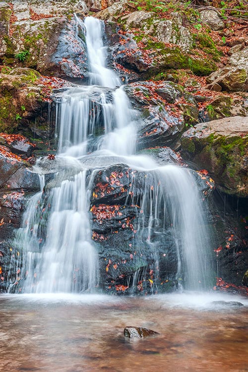
Dark Hollow Falls
- Location: Mile marker 50.7 – Dark Hollow Falls Parking Lot
- Length: 1.4-mile loop
- NPS Trail Information
- Pet Friendly? The trail is not pet-friendly.
- Choose your starting point for this moderately-difficult hike:
- Begin at the Dark Hallow Falls Lot
- Begin at the Byrd Visitor Center and walk the Story of the Forest Trail to the Dark Hollow Falls Trail (2-mile loop)
- Begin from the Fishers Gap Overlook at 49.4 and also view the Rose River Falls (6-mile loop)
The relatively short, moderately difficult trail to the 70-foot Dark Hollow Falls twists and turns down 440-feet to the stunning cascade within the steep valley.
During the summer, soothe your feet in the pool of refreshing mountain water. If you hike during the fall, the surrounding fall foliage adds to the beauty of the waterfall.
If you only have a short time in the park, take 1½ hours to hike to this beauty. You won’t be alone, as it’s considered one of the best hikes near DC and one of the most popular hikes in the park.
Lewis Falls
- Location: Mile marker 51.4 Lewis Falls Parking Lot or 51.2 Big Meadows Amphitheater
- Length: 2-miles out and back or 3.3-mile circuit
- NPS Trail Information
- Pet Friendly? Yes this is a pet-friendly trail.
The short 1-mile trail from the parking area leading directly to the overlook above Lewis Falls catches many hikers by surprise on the return trip out of the steep, rocky valley. The elevation change on this route is 795 feet.
For those who wish for a longer hike, take the 4-hour round trip hike from the Big Meadows Amphitheater on the Lewis Falls Trail past the falls and then return to the campgrounds by turning left onto the Appalachian Trail. This route drops you nearly 1,000 feet from the mountain ridge to the waterfall overlook.
From the rocky viewing platform, see the waterfall from the side as the water drops a magnificent 81 feet and also offers a view of the valley for miles.
Even though this is a short hike, you will work up an appetite, so pack a lunch and stop at the little cove near the large waterfall signage.

South River Falls
- Location: Mile marker 62.7 South River Picnic Grounds
- Length: 2.6 miles round trip (Observation Point), 3.3-mile circuit
- NPS Trail Information
- Pet Friendly? Yes.
After enjoying a picnic lunch at the South River Picnic area, head down the steep moderately-difficult trail, dropping you over 900-feet down the side of the mountain.
Stop first at the 1.3-mile mark and view the third highest falls in the park as it tumbles down 83 feet with a thundering roar.
If you are short on time, a round-trip hike to this point and back will only take you about two hours.
From here, continue ¾-mile down the rocky path and cross one stream to the base of the falls. Once at the base of the falls, head to the pool and gaze up at the thundering water. You will receive a refreshing mist bath for your efforts.
For your return trip, you can return the way you came, or take the horse trail, then turn left onto the Appalachian Trail, which will lead back to the picnic area.
The South River Falls flows year-round. However, in the spring, the water volume makes it much more impressive to watch as it plunges into the pool below.
Doyles River Falls
- Location: Mile marker 81.1 Doyles River parking lot
- Length: 3.3-miles there and back or 7.7-mile circuit
- NPS Trail Information
- Pet Friendly? All trails mentioned are pet friendly.
Numerous routes will lead you to both the 28-foot Upper Doyles River Falls and the beautiful 63-foot Lower Doyles River Falls.
The shortest, at 3.3-miles round trip, will drop in elevation 1,189-feet, cross a stream and take you between 2 and 2½ hours to hike the moderately difficult trail from the Doyles River parking lot.
For those who would like a longer, more strenuous 6½ hour hike, the 7.7-mile circuit around both the Jones Run Falls and Doyles River Falls may be for you. Adding those extra four miles also increases the elevation gain to 2,233 feet and also adds additional stream crossings.
On this route, after passing the Doyles River Falls, proceed down the trail until it crosses the Jones Run Trail. Here you will take a right, passing the Jones River Falls, and then return to the parking area by way of the Appalachian Trail.
Continue walking past Jones Run Falls onto the Doyles River Falls trail, and in approximately two-miles, you’ll reach the second set of waterfalls.
Two distinct cascades make up Doyles River Falls. The 28-foot Upper Falls bounces off a rock platform midway and spreads out before its final landing. The Lower Falls is much longer at 63 feet and is typically narrower. Both are encased in rough rock cliffs and can be a peaceful place to sit and rest.
Jones Run Falls
- Location: Mile marker 84.1 Jones River Parking
- Length: 3.4-miles there and back or 7.7-mile circuit
- NPS Trail Information
- Pet Friendly? Yes, the trail is dog friendly
Jones Run Falls is a beautiful 42-foot cascading waterfall enveloped in moss-covered rocks and green vegetation. The moderately-difficult hike to the falls features a gradual 1,045 feet descent and a stream crossing.
With all the surrounding greenery, this fall is especially beautiful during fall foliage.
For those that would like a longer, more strenuous hike, combine the Doyles River Falls with your hike to Jones River Falls. You can make the loop from here and continuing down the trail past the Upper and Lower Doyles River Falls and then head north on the Appalachian Trail to the Jones River parking area.
However, a less stressful route would be to begin at the Doyles River Falls parking area. This way, the stressful uphill climb is not at the tail end of your hike.
Pin it and start planning!