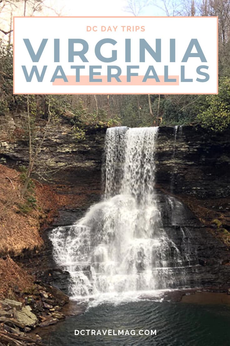
When it comes to waterfalls in Virginia, it’s the end result that makes the waterfall hike worth it. No matter how challenging the journey might seem, when you turn that last corner and see the cascading water, the challenges along the trail disappear.
The Virginia waterfalls, along with the hikes that accompany them, come in all shapes and sizes. Be sure to check the hike difficulty below before heading out.
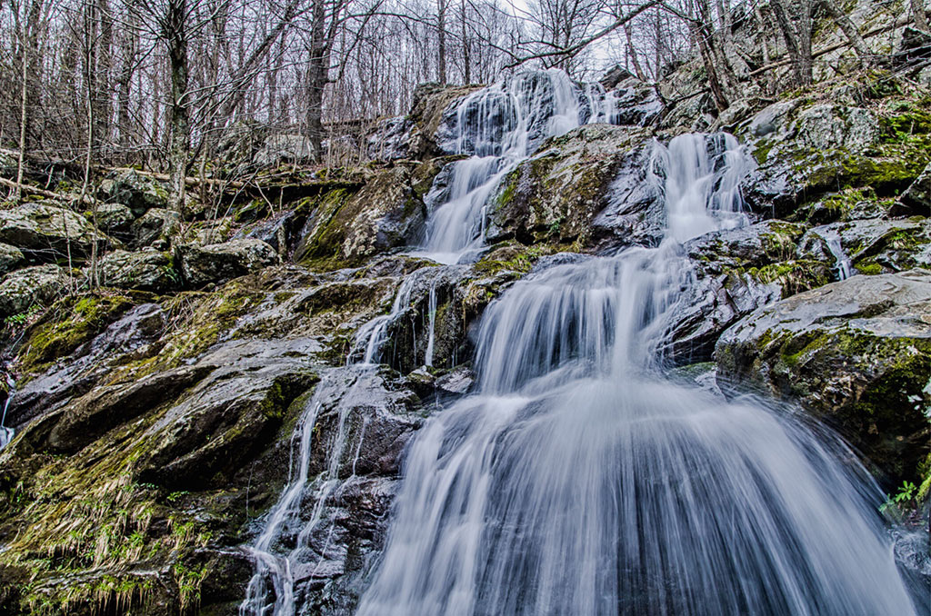
Tips for Visiting Waterfalls in Virginia
- Remember to pack plenty of water, snacks, and a first aid kit before you head down the trail.
- Wherever you go, remember to pack out what you pack in and help to preserve the beauty of each site for the next visitor or your next trip back. Trash never belongs in nature.
- Remember that the water is powerful in a waterfall, rocks are slippery, and safety should be your number one concern, not the perfect photo.
- PARK CLOSURES: Please check the park and state websites carefully for any park closures. Do not head out unless you know you can access each waterfall in Virginia.
Best time to see Virginia waterfalls?
No matter where you wander in the state of Virginia, from the Blue Ridge Mountains to road trips along Skyline drive and into the George Washington National Forest, you will see beauty surrounding you.
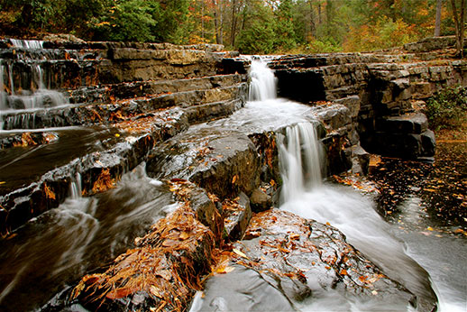
Spring is the best time to see waterfalls in Virginia when water levels are high, but autumn has the best colors.
Summer is a great time to take a hike, as you can cool your toes in some of these waterfalls too. Winters will be chilly, but still worth the hike. You may even get to see a little frozen waterfall on your adventure.

Apple Orchard Falls
- Location: Sunset Field, Milepost 78.4, Blue Ridge Pkwy, Buchanan, VA 24066
- How long does it take? Give yourself 4-5-hours to make this difficult 1.5-mile hike to the 200-foot Apple Orchard Falls.
The hike to Apple Orchard Falls follows the blue-blazed trail beginning from the Blue Ridge Parkway’s Sunset Fields Overlook. From here, you will descend 1,680 feet before coming to the falls viewing area.
Due to snowy conditions, this trail is best between April and October.
Blue Suck Falls
- Location: 14239 Douthat State Park Rd, Millboro, Virginia 24460
Located in Douthat State Park, the 60-foot Blue Suck Falls features three cascades.
The 3-mile round trip hike begins near the Visitor Center. The trail is rated as moderately difficult, but pick up a map at the Visitor Center because there are a variety of paths that cross this blue-blazed (marked) trail.
Once you reach the falls, enjoy a picnic lunch while sitting and resting on the stone bench. You’ll see what we mean when you get there.
Cabin Creek Trail Falls
- Location: Grayson Highlands State Park, Grayson Highland Ln, Mouth of Wilson, VA 24363
From the Massie Gap Parking Area in Grayson Highlands State Park, take the 1.9-mile loop clockwise to enjoy the beautiful path to Lower Cabin Creek Falls. If your timing is right, abundant wildflowers and Mountain Laurel are in full bloom along the trail.
Note: The Upper Falls are only viewed in the spring or after heavy rain.

Cascades Falls Trail
- Location: 2068 Cascade Dr, Pembroke, VA 24136
- Entrance Fee: $3.00 parking fee (The America the Beautiful Interagency Annual Pass and the George Washington & Thomas Jefferson National Forests Annual Day Use Permit are accepted. Your Virginia State Parks pass does not apply on the National Forest.)
Cascade Falls crashes down 69-feet between 200-foot-high cliff walls. There are lots of great spots from different angles to view and take photos of this waterfall.
You can do this easy-to-moderate hike as a 3.8-mile loop or as a 2.3-mile out and back hike. Follow the lower trail for a more scenic route along the stream.
If you visit in the winter, you will view hanging ice formations.

Crabtree Falls
- Location: 11581 Crabtree Falls Hwy., Montebello, VA 24464
- Official park website
- Entrance fee: $3.00 fee to park
- Park amenities: vaulted toilets and picnic tables at the beginning of the trail.
- How long does it take? Allow 2-3-hours to complete this hike
Crabtree Falls offers visitors snapshots of five large cascades as it flows down 1,200 feet. You will not find any other U.S. waterfall east of the Mississippi River with a higher vertical drop.
The 700-feet path to the bottom cascade is wheelchair accessible. However, after that, the trail becomes dirt and rocks and rises1,072 feet in elevation.
From the accessible viewpoint, continue up the trail 2.5 miles to four additional overlooks of the Crabtree Falls. For those adventurous people, continue another mile up the trail to the overlook above the falls. Here you have a beautiful view of the mountains and the Tye River Valley, but you will not see the falls from this spot.
Devil’s Bathtub and Waterfall
- Location: Devils Fork Loop Trail, Route 619, Duffield, VA 24244
- Warning: Hike only when creek flow is low.
Before you head out on this 3.5-mile loop hike, you will need to put on your water shoes or waterproof hiking books. This trail as you cross the creek 15 times.
The reward is a blue-green pool that offers a refreshing summer swim. Once you reach Devil’s waterfall, walk another 200 feet to the 10 by 3-foot Devil’s Bathtub.
Dismal Falls
- Location: 395 Dismal Creek Rd., Pearisburg, VA 24134
- Entrance Fee: none
Dismal Falls is one of the easiest waterfalls in Virginia to access. At 40-foot-wide and 12-feet tall, the walk is an easy 0.1-mile from the parking area to the falls. You can also access the falls from a side trail off of the Appalachian Trail.
Check out Dismal Falls in winter to see it frozen over.
Falling Springs Falls
- Location: Hot Springs Rd, Covington, VA 24426
Along Route 220, five miles north of Covington, you will find the magnificent Fall Springs Falls, an 80-foot waterfall cascading over the hanging ledge.
Falling Springs Falls is one of Virginia’s largest waterfalls. Even though you can see the falls from the road, walk a mere 500-feet to get up close and personal with the falls. Falling Springs Falls is one of the most photographed locations in the Alleghany Highlands region.
Stop and eat at the lovely picnic area while enjoying the sights and sounds of the falls as they crash down before you.

Great Falls National Park
- Virginia Location: 9200 Old Dominion Dr, McLean, VA 22102
- Maryland Location: 11710 Macarthur Blvd, Potomac, MD 20854
- Great Falls National Park Website
- Warning: Before visiting the park, check the National Park website for flood advisories.
Along the Great Falls National Park’s Potomac River, you will find the beautiful Great Falls. Spend time wandering the park, enjoying the multiple cascades and views from the lower level zones.
See the falls from the Virginia side by hiking along the 1½ mile River Trail where you can also view Mather Gorge. From the Maryland side, take the Billy Goat Trail. It offers several access points to view the stunning falls.
The Maryland side also offers a boardwalk trail to an overlook at the falls. Keep in mind that although dogs are welcome in the park, they are not allowed on this boardwalk trail.
Lace Falls
- Location: 6477 South Lee Highway, Natural Bridge, VA 24578
- Entrance Fees: Ages 6-12- $6 and Ages 13 – Adults – $8
- Natural Bridge State Park website
Follow the handicapped accessible trail for 0.8-miles through Natural Bridge State Park and under the 215-foot-high natural bridge. At the end of the trail, you will see beautiful Lace Falls, a 50-foot tall waterfall, come into view.
Little Stoney Creek Falls
- Location: Hanging Rock Recreation Area,1790 Hanging Rock Park Rd, Danbury, NC 27016
Follow the Little Stony Creek National Recreation Trail as it ascends 600-feet over a distance of 2.8 miles, passing deep gorges, boulder fields, and cascades to both the 20-foot Middle Stony Fall and the Upper Falls.
No need for water shoes here, the wooden footbridges along the route will keep your feet from getting wet.
Love waterfalls? Don’t miss the best waterfalls near Washington, D.C.!

Panther Falls
- Address: Panther Falls Road, Amherst, VA 24521
From the Blue Ridge Parkway, take Panther Falls Road for three miles to the parking lot. From the parking area, either take the high or low road to the falls.
You can take as little as 15 minutes to hike this short 0.3-mile trail to the 10-foot Panther Falls or spend the day enjoying the swimming holes around the falls.
The trail only has an elevation change of 29 feet, so it won’t bee too strenuous for little ones.
Panther Falls is a popular swimming hole for the locals, so be prepared for a lot of people on summer days and weekends. For smaller crowds, stop by early on a weekday or in the early evening. Use caution swimming since strong currents can be present. Many people jump into the pool from the rock shelves.
While in the area, visit Statons Creek Falls. It is just a short drive away.
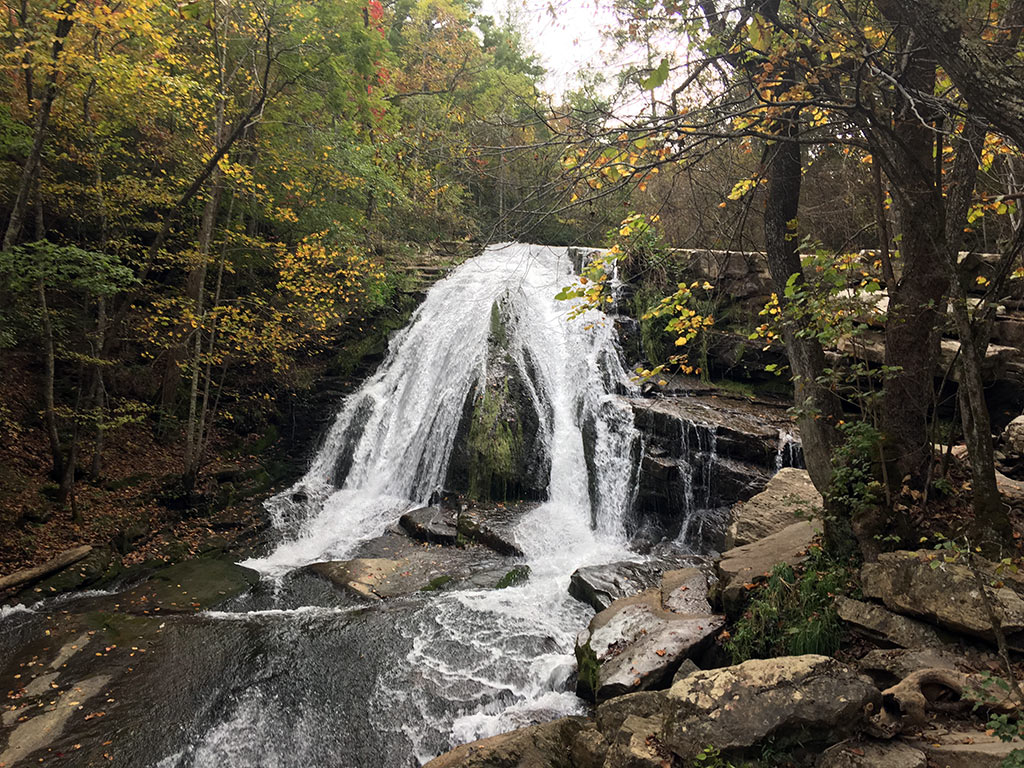
Roaring Run Falls
- Location: 450 Roaring Run Rd, Eagle Rock, VA 24085
This easy 1.5-mile loop only changes 100 feet in elevation, so it is a great family hike that everyone can enjoy. On your way to the falls, take the Streamside Trail that crosses over the stream several times.
You will pass the historic Roaring Run iron furnace. At the site, there are informational signs to provide you some furnace history.
Further down the trail, you will come to the first little fall with a rock slide. Here you can enjoy swimming in the pool and sliding down the rock slide. A short way farther down the trail you will find the 35-foot Roaring Run Falls. You are not permitted to swim.
Enjoy the Woodland Trail on your return trip.
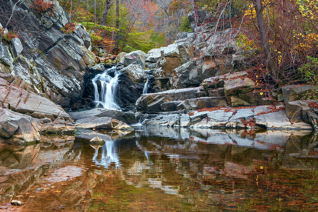
Scott’s Run Falls
- Location: 7400 VA-193, McLean, VA 22102
Just a mile off the beltway, Scott’s Run Nature Preserve offers a little wilderness amongst the busy city. This 1.4-mile hike takes roughly an hour and only has an elevation change of 147 feet.
Walk down the Scott’s Run Nature Preserve’s trail, cross over Scott’s Run and turn right after 3/10 mile, turn right at the concrete posts and cross over the run again. Continue to head up the hill for 1/10 mile for an up-close look at Scott’s Run Falls.
St. Mary’s Falls Trail
- Location: Saint Mary’s Road, Raphine, VA
Within Saint Mary’s Wildernesses 10,000 acres, hike along Saint Mary’s Trail and then Saint Mary’s Falls Trail for a total of 1.9 miles to reach the falls that are surrounded by shelves of rocks. The 25-foot St. Mary’s Falls has a variety of spots to sit and watch or to enjoy a picnic lunch.
In the spring, enjoy the flowering Mountain Laurel that line the trail.
NOTE: If the water is up, be prepared for several creek and river crossings. If the water is low, you should be able to make them all and still have dry feet.
Statons Creek Falls
- Location: 2167-2181 Pedlar River Rd, Vesuvius, Virginia 24483
Statons Creek Falls is a 140-feet roadside waterfall on Pedlar River Road (CR-633), 2.2 miles from US-60. As you proceed down the road, keep your eyes open for the top of the falls on the right. The parking area is about 100 yards before the falls on the left.
Statons Creek Falls is difficult to photograph and offers a dangerous scramble for better views. Be careful and use your judgement when trying to get a better shot of the water.
While in the area, visit Panther Falls 9.5 miles away.

Stile Falls
- Location: 2842 Crockett Springs Road a, Shawsville, VA 24162
- Website for more information
Located on the Camp Alta Mons property, the 40-foot Stile waterfall can be accessed after parking at the camp and walking along the white-blazed trail for 1½ miles. There are creek crossings on this trail, so come prepared with waterproof boots or a towel to dry your feet back at the car.
NOTE: The trail is closed during summer camps and when ice and snow cover the pathway. Please check the website for closures.
Straight Branch Falls
- Location: Jeb Stuart Hwy, Damascus, VA 24236
Straight Branch Falls is another roadside waterfall just 5.6 miles from Damascus on US-58 between the Virginia Creeper Trail and Feather Camp Road. Watch for the pullover on the left side of US-58.
The prettiest time to view this 20-foot waterfall is in the fall.
Shenandoah National Park Waterfalls
Read our full guide to Shenandoah National Park Waterfalls
- Dark Hollow Falls – Begin at mile marker 50.7 to hike the 1.4-mile loop.
- Doyles River Falls – Mile marker 81.1 is your starting point for this 3.3-mile trek.
- Jones Run Falls – Mile marker 84.1 – This roundtrip hike is 3.2 miles and has a gradual 1,045 feet climb to see the 42-foot cascade.
- Overall Run Falls – Mile marker 21.1 – the 93-foot tall waterfall at the end of this 5.1-mile round trip hike with a 1,291 change in elevation is your reward.
- Rose River Falls – Mile marker 62.8 – The roundtrip hike is 2.6 miles. There is an 850-foot change in elevation. The waterfall is 83 feet tall.
- South River Falls – From the South River Picnic area, hike 1.3-miles to the falls. There is an 850-foot elevation change each way and should take around 2 hours to hike.
- White Oak Canyon Falls – Mile marker 42.6 and Cedar Run Falls – Mile marker 45.6 – Combine these two for a very strenuous 7.3-mile loop.
Pin It and Start Planning
Your VA Waterfalls Hike!